Friday, 15 April 2016

Philippines protected areas protecting?

Posted by Stu and Aldrin Mallari

In a paper published in the April issue of the journal Ambio, Aldrin Mallari, Nigel Collar, Phil McGowan and Stu look critically at placement and management of protected areas in the Philippines – and ask whether they are doing an effective job at delivering protection.


Aichi Target 11 of the Convention on Biological Diversity urges that nations protect at least 17% of their land, and that protection is effective and targets areas of importance for biodiversity. So, as well as covering a ‘reasonable’ proportion of a nation’s land surface, a quite hard-and-on-the-face-of-it-simple measure of a country’s commitment to conservation, the target also requires that

-    Those national parks etc are in the right places. We know that protected areas have a tendency to be placed in areas which don’t really need protection – ‘rock and Ice’ parks (Joppa & Pfaff 2009).
 

-    Protected areas do actually do their job in delivering protection to key wildlife – they are not ‘paper parks’ (e.g. Di Minin & Toivonen 2009).

Five years before reporting on Aichi targets is due, we assessed the Philippines’ current protected area system for biodiversity coverage, appropriateness of management regimes and capacity to deliver protection. Although protected estate already covers 11% of the Philippines’ land area, 64% of its Key Biodiversity Areas (KBAs) remain unprotected.


Mindanao bleeding-heart Gallicolumba crinigera is one of many lowland forest specialists in Philippines. This one was found in a snare 200 m from the HQ at Rajah Sikatuna National Park, Bohol (Photo: Stu).

We asked two broad questions of the Philippines protected areas network:

1. Are PAs appropriately positioned to protect areas of particular importance for biodiversity?

2. Are management systems in place and is there adequate capacity in the current protected area system to enable them to function effectively?


Puerto Princesa Puerto Princesa Subterranean River National Park in Palawan (Photo: Dave Lee)

The answer to the first question is, we believe, ‘No’.

While a good proportion of Philippines land area falls within protected areas, there is only a 36% overlap between established protected areas and KBAs (Key Biodiversity Areas – those with the most important species) meaning that 64% of key areas remain unprotected. This shortfall is particularly apparent in small islands like Siquijor (100% unprotected), the Sulus (98%), Batanes/Babuyanes and Greater Negros/Panay (both 75% unprotected).

When we look within a selection of protected areas, we find that there is a mismatch between what is needed to protect key species, and what the protected areas actually protect. The majority of threatened species in Philippines depend on lowland forest – of 40 IUCN threatened bird species, 33 are found only below 1,500 m a.s.l. while 29 are ‘highly forest dependent’. The proportion of strictly protected land that covers lowland primary forest is low – at best 30%, and in some cases none at all.


Mount Apo National Park on Mindanao - a beleaguered protected area due to pressure to convert forest to banana plantations and human habitation (Photo: Aldrin Mallari).

The answer to the second question is, again ‘No’.

Only around 17% of protected areas have a proper management plan and a protected area management board to guide their protection activities. Annual budgets to protect are pitiful in some cases – less than one US$10 per Sq Km in some parks (see Table below). Interestingly, in all five parks looked at, regular ‘BMS’ monitoring data were collected by park staff, but no analysis has been done on all these data.


Through the assistance of the German Government (through the Protected Area Management Effectiveness Project and other similar projects of GIZ) and the USAID (through B+WISER), the Philippines Department of Environment and Natural Resources (DENR) has started to recognise these mismatches and have taken bold moves to rectify the situation. 


Protected areas management planning (Photo: Aldrin Mallari).


The current list of protected areas are being rationalised, management plans are being revised, new and improved management systems are being set up, capacity of management authorities are being enhanced either by skills upgrade and/or additional budget allocations. The system of monitoring of protected areas are currently being improved by using simplified, state of the art, spatially sensitive, mobile technology to complement the existing BMS system. We are thrilled to see more of these positive changes in future, and hope to see continued bilateral support to DENR towards an expanded and more effective network of protected areas in the country!

Mentoring of wildlife patrol staff (Photo: Aldrin Mallari).

References

Di Minin, E. & Toivonen, T. (2009). Global Protected Area Expansion: Creating More than Paper Parks. Bioscience 65: 637-638.

Joppa, L.N. & Pfaff, A. (2009). High and Far: Biases in the Location of Protected Areas. PLOS One http://dx.doi.org/10.1371/journal.pone.0008273

Monday, 4 January 2016

Parrots International Symposium, and Intervales birds


 Posted by Stu


In November, I visited Brazil for the first time in more than ten years. My principal reason for the visit was to speak at the ninth Parrots International Symposium, in Campo Grande. Parrots International (PI) is a US-based NGO, founded by Marie and Mark Stafford, and devoted to welfare of both companion parrots and parrots in the wild. They are involved in funding and running a whole range of projects on wild parrots. 


A major activity of PI is the organisation of an annual parrot symposium, in 2015 held for the first time outside of USA. Simon Valle spoke at the PI symposium in 2013 about his Grey Parrot project on Principe – this time I was there to talk about our Grey Parrot work in general across several African countries. Also speaking were Neiva Guedes (Instituto Arara Azul), Pepe Tella (Estacion Biologica de Doñana), Tom White (USFWS), Indira Lacerna-Widman (Katala Foundation), and Thomas Arndt (Funds for Endangered Parrots). 


A pair of Blue-and-yellow Macaws Ara ararauna on streetlights in Campo Grande (Photo: Peter Widman)
Urban Blue-and-yellow Macaw (Photo: Steve Brookes www.wildparrotsupclose.com)
  
Campo Grande is an amazing city, stuffed with wildlife. There were Agoutis and Bare-faced Curassows by the side of the road, and Blue-and-yellow Macaws hanging off the lamp posts. After the conference, I went with Pedro Develey from SAVE Brasil, the Brazilian BirdLife partner, to help organise a new project on birds in Minas Gerais. More on this soon.
 
Southern Red-shouldered Macaws Diopsittaca cumanensis also live 'comfortably' in Campo Grande (Photo: Steve Brookes www.wildparrotsupclose.com)


Blue-and-yellow Macaw pair at nest in dead palm (Photo: Steve Brookes www.wildparrotsupclose.com)

(Photo: Steve Brookes www.wildparrotsupclose.com)

My final stop was Intervales State Park, around five hours bus and taxi ride from Sao Paulo. I visited this place with Mauro Galetti from UNESP many years ago. Then we stayed at one of the guard/research posts in the lowlands of the park – I’m not sure where we were but I do remember seeing Jacutinga and some other lowland Atlantic Forest goodies. This time I was at the main complex accessed from Ribeirão Grande. This is a stunning place for birding – three nights at Pousada Esquilo, mountains of food and the superb Faustino to guide cost around £120.


Above: Great forest at Intervales State Park (Photo: Stu); Below: the Near-threatened White-breasted Tapaculo (Photo: Dario Sanches).

We saw lots of birds including some like Spot-winged Wood-quail, Hooded Berryeater, and Atlantic Forest Royal Flycatcher which I’ve not seen for years, plus some great new birds including Such’s and Short-tailed Antthrushes, Variegated Antpitta, White-breasted Tapaculo and Rusty-breasted Nunlet. I also finally saw the bamboo-loving Temminck’s Seedeater, and there is even an area where they put out corn for the lovely Red-and-white Crake.

Above: Red-and-white Crake comes to corn at the marsh by the Administration, along with Blackish Rail (Photo: Francesco Veronesi); Below: Atlantic forest from my room at Pousada Esquilo (Photo: Stu).

Thursday, 17 December 2015

‘Growing’ new habitat to predict the future for key species

Posted by Matt Geary and Stu

Accurate predictions of the impacts of future land use change on species of conservation
concern can help to inform policy-makers and improve conservation measures. In a new paper just published in PLOS One, we introduce a method, based on open source software, which integrates habitat suitability modelling with scenario-building. We illustrate its use by investigating the effects of alternative land use change scenarios on landscape suitability for black grouse Tetrao tetrix in the Scottish uplands.


Likely changes in the uplands

The first step was to build a habitat suitability model for the species, in this case using the well-used MaxEnt. This gave a standard map of suitability for pixels across the 800 sq km landscape in Perthshire. We wanted to simulate how the upland area might change over the next 20 years so we asked upland experts how they thought the landscape might change – they told us  that most likely were changes from moorland and grazed land to open canopy forestry due to native forestry planting schemes and grazed land to moorland via a reduction in grazing.


A moorland and open woodland mix in Perthshire - a potential result of the reduced grazing scenario which resulted in beneficial landscapes for black grouse (Photo: Matt Geary).

Growing patches of new habitat

To represent how these changes in land use would affect the area, we grew patches of new habitat within the existing landscape (e.g. new patches of open woodland where moorland currently exist). We grew the new patches using a piece of old script in Mathematica supplied by Ed Harris here at MMU, which was updated to work in R and embedded into our model. For each scenario, the cover of different land use types was altered by 5–30% from 20 random starting locations – this enabled us to look at how the amount of new habitat and its spatial positioning of the new land uses might affect their impact on the grouse. We then ran the MaxEnt again with the 20 new landscapes and assessed changes in suitability – much like people do with climate change scenarios and their effects on species ranges.


Effects of land use changes

The scenario where grazed land was replaced by moorland and open forestry was the most beneficial for black grouse, and ‘increased grazing’ (the opposite conversion) the most detrimental. Positioning of new land use blocks was shown to be very important. So it is not just a case of a certain benefit or loss brought about by a certain amount habitat change - where those habitat changes occurred was also very important. This might be helpful to local land use planners and habitat managers – habitats could be placed so as to maximise benefits for a key species, or at least to minimise their detrimental effects.


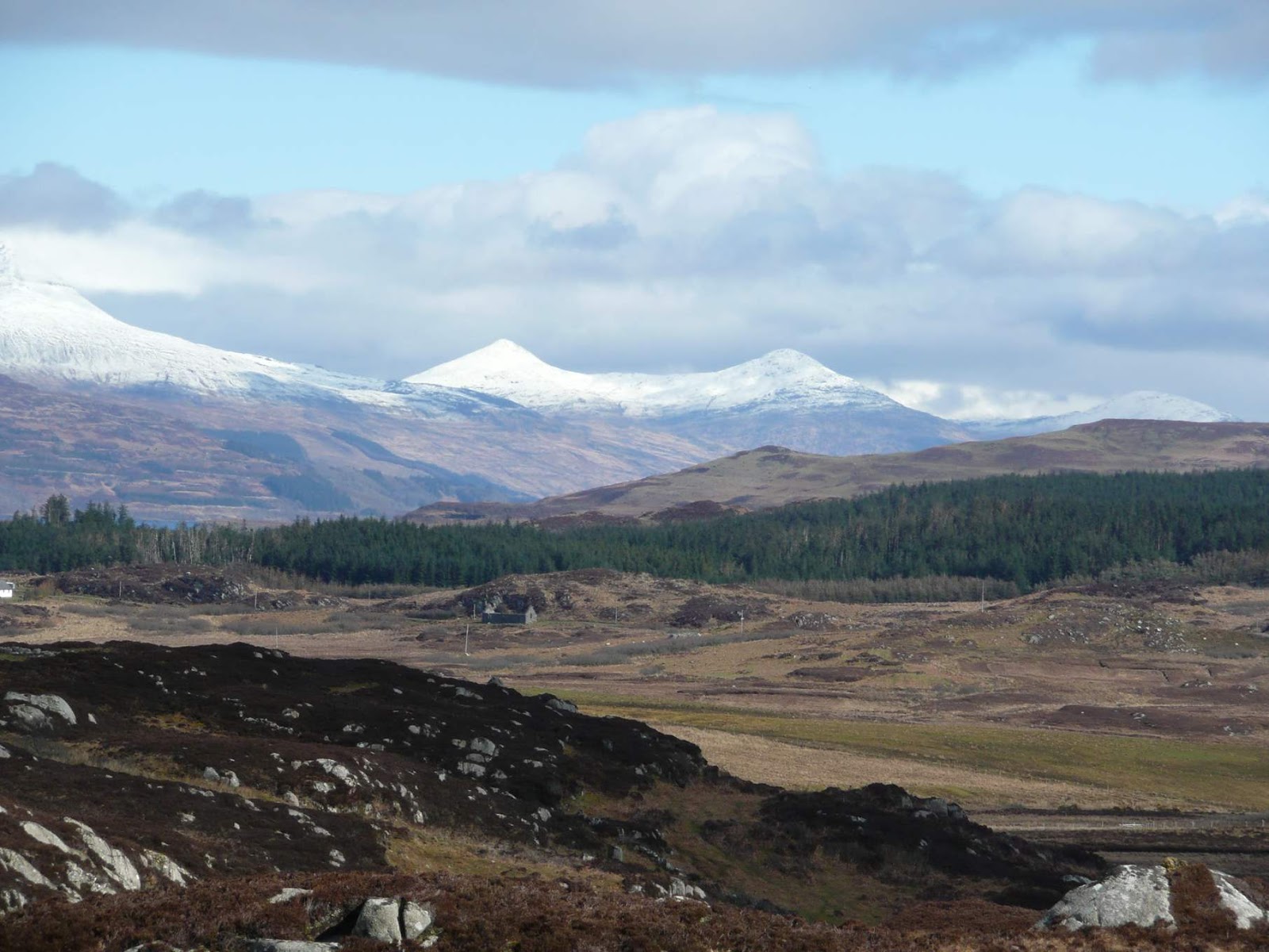
An 'upland' mosaic: Ross of Mull looking across Scoor forest towards Ben Mor (Photo: Alan Fielding).

Another important finding was that, while increasing the area of open canopy forestry caused a proportional decrease in suitability, suitability gains for the ‘reduced grazing’ scenario were nonlinear. Reducing grazing slightly to create small additional amounts of moor and open canopy woodland had small benefits to grouse, but reducing it by 20% had disproportionately large benefits in terms of habitat suitability for the species. Again, this kind of result might help inform local land management and even regional policy such as grant schemes promoting land use changes.

This ‘Scenario-led’ landscape simulation modelling can be applied in assessments of the impacts of land use change both on individual species but also on diversity and community measures, or ecosystem services. A next step would be to include landscape configuration more explicitly in the simulation models, both to make them more realistic, and to examine the effects of habitat placement more thoroughly. 

Matt's PhD was funded by Manchester Metropolitan University and the World Pheasant Association. Matt is now a lecturer in Conservation Biology and Animal Behaviour at the University of Chester. Contact him at M.Geary@Chester.ac.uk. More information about his research is at http://mattgeary.github.com.