Showing posts with label Alumni. Show all posts

Saturday, 12 May 2018

Worrying news on Timneh Parrots from Gola


Posted by Simon Valle & Stuart Marsden

The Timneh Parrot (Psittacus timneh) together with the congeneric Grey Parrot (Psittacus erithacus) has recently been uplisted, to Endangered based on the suspected decline due to habitat loss and trapping for the pet trade (BirdLife International 2018). However, the hard truth is that we have hardly any data on the size and trends of the populations that dwell in the remaining forest patches across its range. As part of a project generously funded by the Parrot Wildlife Foundation, successfully launched inaugurated with a productive workshop at the Gola Rainforest National Park (GRNP), Dr Simon Valle (Bangor University) has spent four weeks surveying in and around GRNP to understand how abundant the species may be. 

Community guide Mohamed Nyallay (left) and porters Mustapha Kanneh (centre) and Keni Desmond on their way to set a base camp in the heart of Gola Rainforest National Park (Photo: S. Valle)

Preliminary results from the surveys have raised some serious concerns for the species in Gola, despite being probably one of the best preserved and managed protected areas in West Africa. Simon and his team often struggled to find any parrots even in the better-preserved forest at the core of the national park. Encounters were rare and far apart and judging from the extremely low encounter rates (0.3 parrots/hour), and, until the analysis is done, we can only assume that Timneh Parrots presumably persist at very low densities in the area as a whole. These figures are alarming if we compare them to those of healthy populations of the congeneric Grey Parrot such as the 30 ± 8 parrots per sq km in Lobéké National Park, Cameroun (Marsden et al. 2015), or the 59 ± 4 parrots  per sq km on the Island of Príncipe, São Tomé & Príncipe (Valle et al. 2017). 


A rare encounter in Gola forest. 
Community Guide Mohamed Mansare` listens to a 
group of Timneh Parrots feeding on a nearby tree.


Most encounters were from the 4-km buffer zone that surrounds the park, where the forest is under continuous threat from inhabitants of the surrounding settlements. The buffer zone holds pockets of reasonably intact forest and hosts some very successful wildlife -friendly cocoa farms managed in partnership with the park authorities. However, in some areas, the buffer zone still bears the clear signs of slash-and-burn farming, selective logging for valuable timber and mining for gold and diamonds. These are the areas where the work of the park authorities is the most difficult and the survival of the remaining forest most fragile.


A team surveys for Timneh Parrots in the 4-km buffer zone around the Gola Rainforest National Park, where large areas are cleared with fire to make space for subsistence farming (Photo: S. Valle)


The data collected in GRNP are an important alarm bell and shows us that a well-protected and carefully managed protected area may not be sufficient to guarantee the recovery of a population to a healthy state, or at least not before many years (Valle et al. 2018). Moreover, these results highlight the importance of performing similar surveys across the range to assess the true conservation status of this species and the need for consistent monitoring of the remaining populations. With this in mind, and following up on the successful training held in GRNP, Simon has delivered a further workshop at the HQ of the National Protected Areas Authority, the government agency which manages all protected areas across the country. Together with Prof Stuart Marsden (Manchester Metropolitan University), Simon will keep on working closely with the NPAA and GRNP to develop a long-term countrywide monitoring scheme for Timneh Parrot, probably the first of its kind in Africa.

References

BirdLife International (2018) Species factsheet: Psittacus timneh. Downloaded from http://www.birdlife.org on 12/05/2018
Marsden, S.J., Loqueh, E., Takuo, J.M., Hart, J.A., Abani, R., Ahon, D.B., Annorbah, N.N.D., Johnson, R., & Valle, S. (2015) Using encounter rates as surrogates for density estimates makes monitoring of the heavily-traded grey parrots achievable across Africa. Oryx 50(4):617-625
Valle, S., Collar, N.J., Harris, E., & Marsden, S.J. (2017) Spatial and seasonal variation in abundance within an insular grey parrot population. African Journal of Ecology 55(4):433-442
Valle, S., Collar, N.J., Harris, E., & Marsden, S.J. (2018) Effects of trapping method and capture rate variability on harvest sustainability in a heavily traded parrot. Biological Conservation 217:428–436


Friday, 1 July 2016

A new Viper for Europe - already Endangered

Posted by Stu

It is not every day that a new vertebrate is described from Europe. In a new paper published in Journal of Zoological Systematics and Evolutionary Research, Samuele Ghielmi and Michele Menegon (MUSE - Museo delle Scienze, Trento), Lorenzo Laddaga (Museo di Scienze, Domodossola), Sylvain Ursenbacher (University of Basel) and Stu talk about the ‘discovery’, morphology, genetics and conservation of Vipera walser, a new viper species from the north-western Italian Alps.


In 2005, Samuele Ghielmi noticed something odd about adders and lizards in the north-western Italian Alps. First, there was a population of European Adder Vipera berus in the area that was disjunct from V. berus populations in the rest of Europe. More intriguing was that within this area, the Common Lizard Zootoca vivipara, one of the adder’s main prey items over much of its European range, was replaced by Zootoca carniolica, its ancestral oviparous (egg-laying) sister species. This observation sparked a morphological and genetic study which led to the naming of Vipera walser. 


The beast - variation in individuals of Vipera walser sp. nov. Adult males (left) and adult females (right).

Vipera walser sp. Nov.

The new species is remarkably distinct genetically from both V. berus and other vipers occurring in western Europe. It shows closer affinities to V. darevskii and V. kaznakovi, species occurring in the Caucasus as well as to the widespread Meadow Viper V. ursinii complex. Morphologically, the new species appears to be more similar to V. berus than to its closest relatives occurring in the Caucasus, but can be readily distinguished in most cases by a combination of meristic features such as number of crown, loreal and periocular scales.


Phylogenetic tree showing position of Vipera walser, and relationships with other Vipera species.

Already Endangered

My own main interest in the new viper is in its conservation. The species is extremely range-restricted (< 500 sq. km) and occurs only in two disjunct sites within the high rainfall valleys of the Alps north of Biella. We recommend that the new species should be classified as globally ‘Endangered’ due to its small and fragmented range, and an inferred population decline (Red List criteria B1a/B2a). The other species closely related to walser are also either Endangered (V. kaznakovi) or Critically Endangered (V. darevskii) so the entire clade is in serious danger of being lost.

The new viper appears to be quite common in suitable habitat within its range. We need detailed studies of the species’ precise habitat requirements, to determine how past and current land use changes have affected the species, and how they might be altered to benefit the species in the near future. The species appears to inhabit open areas, often with rocky outcrops, and may not tolerate woodland unless it is very sparse. European mountains experienced a long period of agropastoral expansion from the Late Middle Ages to the 19th century, with large areas of the Alps converted to pasture and heathlands. These open landscapes were presumably beneficial for V. walser. However, the decline in agropastoral activities in the last 100 years and associated afforestation is probably the biggest threat to the species. Other immediate threats are culling and collection of specimens by enthusiasts.


Habitat of Vipera walser sp. nov

Longer term, the ability of V. walser to withstand or adapt to climatic change expected to take place within its range will be crucial. Its current habitat is restricted to just a few valleys, which experience some of the highest rainfall in the Alps. Climate models indicate that in the next 20 years, these valleys will become far wetter and warmer. Research on how the viper might be able to react to climate change is a priority.


Sunday, 12 June 2016

Better forest 'simply' means more frugivores

Posted by Stu
 

We think our paper, just published in Forest Ecology & Management, has quite an important message, and one that should be encouraging, even in an archipelago with so little forest remaining and so many threatened species.


The study was part of Carmela Espanola’s PhD here at MMU and supervised by Nigel Collar, Aldrin Mallari and myself. She and her team walked around 500 km of transects, at 24 sites on the Philippine island of Luzon, looking for large avian frugivores. The target species included large pigeons, hornbills and parrots – birds crucial to proper functioning of forests in the tropics. If these seed dispersing birds disappear or become ‘functionally extinct’ then we might expect serious consequences for the health of forests.

The Imperial pigeons Ducula are key seed dispersers in southeast Asia's forests (Photo: Christine E. Telesforo)

What we did was to relate the presence of the different species to a series of habitat predictors, recorded at over 1,200 plots along the transects – these included things like altitude, canopy cover, and other indications of the quality of the forest. Basically, we asked what the difference was between plots that contained the frugivore species and those where the species was not found.

Survival for species like this Luzon Bleeding-heart is not just a matter of finding suitable habitat, but also avoiding hunting or capture (Photo: Carmela Espanola)
Our first finding was not so surprising - Frugivore species richness was highest in forest with large-girthed trees. But more interesting was that some small-scale agricultural disturbance was tolerated or even favoured by some species. World birders will know well this pattern – low intensity use of forests, which could be a little logging, or especially the creation of small mixed gardens within the forest, can be very good spots to see frugivorous birds. Importantly, our study showed that frugivore richness was highest in forests on flat ground, areas which are usually the first to be converted to agriculture. 

White-eared Brown-dove can tolerate seriously degraded forest, but still prefers good forest on Luzon (Photo: Pablo Espanola)

But I think the most important aspect of the study was our attempt to find non-linearities and other complexities in frugivore presence and richness responses along the habitat quality gradient. I, for one, felt sure that we would find some places along the disturbance gradient where there would be sudden rises in frugivore abundance – and, that in turn, management could be targeted at these points to gain disproportionate benefits for wildlife.


The forest disturbance gradient - importantly, we found linear increases in frugivore richness along this gradient.

We did not find that – rather, the probability of occurrence increased linearly along the forest quality/restoration gradient. While the precise benefits in terms of seed dispersal, and costs of management, at different points along the quality/restoration gradient are likely to be themselves complex, avian frugivores benefit proportionately from step improvements right along the gradient. Thus, any actions to improve forest quality on Luzon, from reforesting the most degraded lands to preventing degradation of relatively healthy forests, are likely to benefit frugivores. 

Carmela's PhD was funded by Loro Parque Fundacion. She now lectures at University of the Philippines.


Friday, 15 April 2016

Philippines protected areas protecting?

Posted by Stu and Aldrin Mallari

In a paper published in the April issue of the journal Ambio, Aldrin Mallari, Nigel Collar, Phil McGowan and Stu look critically at placement and management of protected areas in the Philippines – and ask whether they are doing an effective job at delivering protection.


Aichi Target 11 of the Convention on Biological Diversity urges that nations protect at least 17% of their land, and that protection is effective and targets areas of importance for biodiversity. So, as well as covering a ‘reasonable’ proportion of a nation’s land surface, a quite hard-and-on-the-face-of-it-simple measure of a country’s commitment to conservation, the target also requires that

-    Those national parks etc are in the right places. We know that protected areas have a tendency to be placed in areas which don’t really need protection – ‘rock and Ice’ parks (Joppa & Pfaff 2009).
 

-    Protected areas do actually do their job in delivering protection to key wildlife – they are not ‘paper parks’ (e.g. Di Minin & Toivonen 2009).

Five years before reporting on Aichi targets is due, we assessed the Philippines’ current protected area system for biodiversity coverage, appropriateness of management regimes and capacity to deliver protection. Although protected estate already covers 11% of the Philippines’ land area, 64% of its Key Biodiversity Areas (KBAs) remain unprotected.


Mindanao bleeding-heart Gallicolumba crinigera is one of many lowland forest specialists in Philippines. This one was found in a snare 200 m from the HQ at Rajah Sikatuna National Park, Bohol (Photo: Stu).

We asked two broad questions of the Philippines protected areas network:

1. Are PAs appropriately positioned to protect areas of particular importance for biodiversity?

2. Are management systems in place and is there adequate capacity in the current protected area system to enable them to function effectively?


Puerto Princesa Puerto Princesa Subterranean River National Park in Palawan (Photo: Dave Lee)

The answer to the first question is, we believe, ‘No’.

While a good proportion of Philippines land area falls within protected areas, there is only a 36% overlap between established protected areas and KBAs (Key Biodiversity Areas – those with the most important species) meaning that 64% of key areas remain unprotected. This shortfall is particularly apparent in small islands like Siquijor (100% unprotected), the Sulus (98%), Batanes/Babuyanes and Greater Negros/Panay (both 75% unprotected).

When we look within a selection of protected areas, we find that there is a mismatch between what is needed to protect key species, and what the protected areas actually protect. The majority of threatened species in Philippines depend on lowland forest – of 40 IUCN threatened bird species, 33 are found only below 1,500 m a.s.l. while 29 are ‘highly forest dependent’. The proportion of strictly protected land that covers lowland primary forest is low – at best 30%, and in some cases none at all.


Mount Apo National Park on Mindanao - a beleaguered protected area due to pressure to convert forest to banana plantations and human habitation (Photo: Aldrin Mallari).

The answer to the second question is, again ‘No’.

Only around 17% of protected areas have a proper management plan and a protected area management board to guide their protection activities. Annual budgets to protect are pitiful in some cases – less than one US$10 per Sq Km in some parks (see Table below). Interestingly, in all five parks looked at, regular ‘BMS’ monitoring data were collected by park staff, but no analysis has been done on all these data.


Through the assistance of the German Government (through the Protected Area Management Effectiveness Project and other similar projects of GIZ) and the USAID (through B+WISER), the Philippines Department of Environment and Natural Resources (DENR) has started to recognise these mismatches and have taken bold moves to rectify the situation. 


Protected areas management planning (Photo: Aldrin Mallari).


The current list of protected areas are being rationalised, management plans are being revised, new and improved management systems are being set up, capacity of management authorities are being enhanced either by skills upgrade and/or additional budget allocations. The system of monitoring of protected areas are currently being improved by using simplified, state of the art, spatially sensitive, mobile technology to complement the existing BMS system. We are thrilled to see more of these positive changes in future, and hope to see continued bilateral support to DENR towards an expanded and more effective network of protected areas in the country!

Mentoring of wildlife patrol staff (Photo: Aldrin Mallari).

References

Di Minin, E. & Toivonen, T. (2009). Global Protected Area Expansion: Creating More than Paper Parks. Bioscience 65: 637-638.

Joppa, L.N. & Pfaff, A. (2009). High and Far: Biases in the Location of Protected Areas. PLOS One http://dx.doi.org/10.1371/journal.pone.0008273

Thursday, 17 December 2015

‘Growing’ new habitat to predict the future for key species

Posted by Matt Geary and Stu

Accurate predictions of the impacts of future land use change on species of conservation
concern can help to inform policy-makers and improve conservation measures. In a new paper just published in PLOS One, we introduce a method, based on open source software, which integrates habitat suitability modelling with scenario-building. We illustrate its use by investigating the effects of alternative land use change scenarios on landscape suitability for black grouse Tetrao tetrix in the Scottish uplands.


Likely changes in the uplands

The first step was to build a habitat suitability model for the species, in this case using the well-used MaxEnt. This gave a standard map of suitability for pixels across the 800 sq km landscape in Perthshire. We wanted to simulate how the upland area might change over the next 20 years so we asked upland experts how they thought the landscape might change – they told us  that most likely were changes from moorland and grazed land to open canopy forestry due to native forestry planting schemes and grazed land to moorland via a reduction in grazing.


A moorland and open woodland mix in Perthshire - a potential result of the reduced grazing scenario which resulted in beneficial landscapes for black grouse (Photo: Matt Geary).

Growing patches of new habitat

To represent how these changes in land use would affect the area, we grew patches of new habitat within the existing landscape (e.g. new patches of open woodland where moorland currently exist). We grew the new patches using a piece of old script in Mathematica supplied by Ed Harris here at MMU, which was updated to work in R and embedded into our model. For each scenario, the cover of different land use types was altered by 5–30% from 20 random starting locations – this enabled us to look at how the amount of new habitat and its spatial positioning of the new land uses might affect their impact on the grouse. We then ran the MaxEnt again with the 20 new landscapes and assessed changes in suitability – much like people do with climate change scenarios and their effects on species ranges.


Effects of land use changes

The scenario where grazed land was replaced by moorland and open forestry was the most beneficial for black grouse, and ‘increased grazing’ (the opposite conversion) the most detrimental. Positioning of new land use blocks was shown to be very important. So it is not just a case of a certain benefit or loss brought about by a certain amount habitat change - where those habitat changes occurred was also very important. This might be helpful to local land use planners and habitat managers – habitats could be placed so as to maximise benefits for a key species, or at least to minimise their detrimental effects.


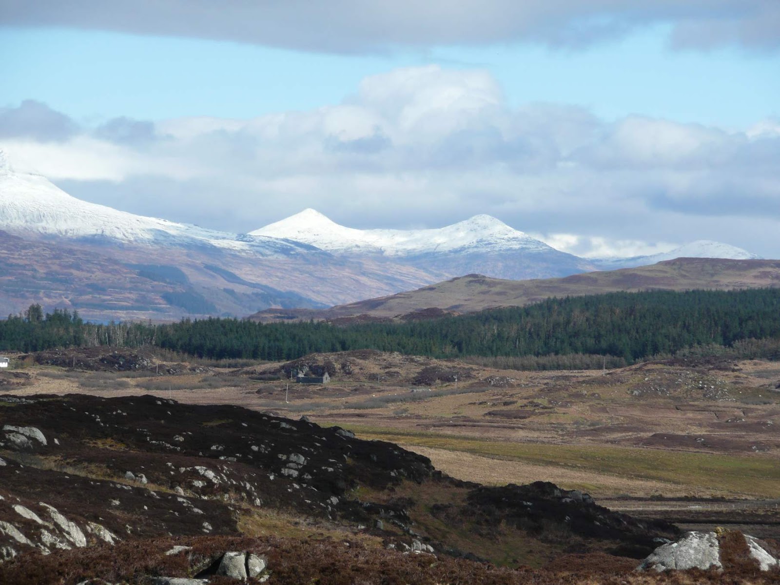
An 'upland' mosaic: Ross of Mull looking across Scoor forest towards Ben Mor (Photo: Alan Fielding).

Another important finding was that, while increasing the area of open canopy forestry caused a proportional decrease in suitability, suitability gains for the ‘reduced grazing’ scenario were nonlinear. Reducing grazing slightly to create small additional amounts of moor and open canopy woodland had small benefits to grouse, but reducing it by 20% had disproportionately large benefits in terms of habitat suitability for the species. Again, this kind of result might help inform local land management and even regional policy such as grant schemes promoting land use changes.

This ‘Scenario-led’ landscape simulation modelling can be applied in assessments of the impacts of land use change both on individual species but also on diversity and community measures, or ecosystem services. A next step would be to include landscape configuration more explicitly in the simulation models, both to make them more realistic, and to examine the effects of habitat placement more thoroughly. 

Matt's PhD was funded by Manchester Metropolitan University and the World Pheasant Association. Matt is now a lecturer in Conservation Biology and Animal Behaviour at the University of Chester. Contact him at M.Geary@Chester.ac.uk. More information about his research is at http://mattgeary.github.com.